History of the Yarra River

The Yarra River runs for approximately 242kms from Mt Baw Baw, in the Yarra Ranges National Park to its mouth at the entrance to Port Phillip Bay at Newport.
Of the 242km length of the river, just 22km is navigable by boat. The river is relatively narrow and shallow with an average depth approximately 2.5m.
The lower section of the Yarra River meandered through the heart of Melbourne City and was instrumental in making Melbourne into the city it is today. Most of Melbourne’s attractions are in close vicinity to the river.
The river was a significant food source and meeting place for indigenous Australians from prehistoric times. The Yarra River was initially called Birrarung by the Wurendjeri people. It is thought that Birrarung is derived from Wurundjeri words meaning “ever flowing”.
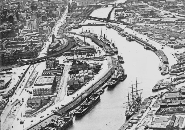
The river was utilised primarily for agricultural by early European settlers. The landscape of the river has changed dramatically since 1835. The course of the river has been progressively disrupted and widen in places.
The Yarra is often referred to “the river that runs upside down” due to its muddy coloured water – caused by significant land clearing and development after the 1800s which resulted in tiny clay particles being washed downstream.
The murky appearance of the river doesn’t mean it’s not clean.
The first crossing across the Yarra River was Princess Bridge which was built in 1844, this was the beginning of the Victorian gold rush and the river was extensively mined, creating the Pound Bend Tunnel in Warrandyte. Princess Bridge was later replaced with the current bridge in 1888.
The Yarra River has one island called Herring Island which is situated approximately 3kms from the CBD in Como and is only accessible by boat. Herring Island was created from dredging spoil in the 1920s when a new river channel was cut at Burnley to prevent flooding of the Yarra River.
The lower part of the Yarra River also seen significant transformations in the later 1800s. Driven by industrialisation the growth of shipping on the river led to major infrastructure works. The Coode Canal was a major project and improved access for ships to Melbourne’s main river docks. This also included the creation of Victoria Harbour which was dug out from swampy land and now home to Docklands.
What was known as Coode island is now home to Australia’s busiest container terminals with Swanston Dock. And the canal has since being filled in.
In the 1960s there was a growing awareness of neglect towards the Yarra River and by the 1970s development commenced along the Yarra River banks in the CBD. With the Victorian Arts Centre. By 2000 the river through Melbourne City became a focus for major government projects. Today the river is bustling with activities, many bars and restaurants line the Yarra River and are home for rowing clubs, recreational boating and many parks.
To learn more about the Yarra River book a private guided river cruise on board with us.